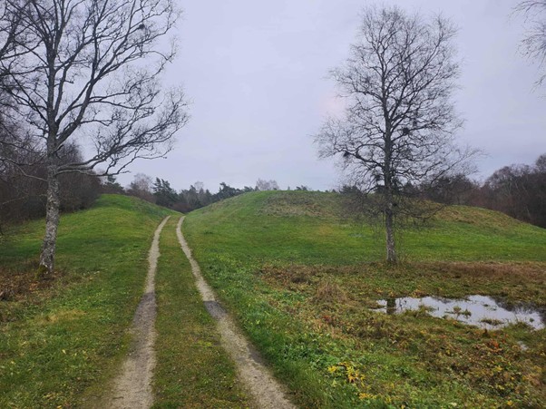
Kaarma hill fort. On the right, part of the presumed moat filled with water in autumn.
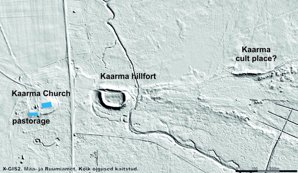
Kaarma hill fort is located220 m northeast of Kaarma church. It was built on a former river island, where the Põduste River has since split into two. This meant that the stronghold was surrounded by water on all sides. The stronghold is part of a ridge, with Kaarma church at its western end and sandy areas to the east. According to folklore, one of the most important cult sites of the islanders, Kaarma sacrificial hill, was located near the stronghold. Judging by the descriptions, it was located500 m east of the stronghold.
Map of Kaarma hill fort and the surrounding landscape. Geoportal of the Land and Spatial Development Board.
The stronghold was built at approximately the same distance from the most important manors in the surrounding area, at the center of the best farmlands that belonged to the elite of prehistoric times. The most important manors in the vicinity include Loone (Klausholm), Meedla (Mehelen), and Vana-Kaarma (Karmelhof). It can be assumed that the elite residing in these also controlled the stronghold. There is a bog immediately north and northeast of the stronghold. The Põduste River, which runs alongside the stronghold, flows into the sea at Kuressaare, into what was once a bay, which in the Middle Ages was located about 7 km from the stronghold.
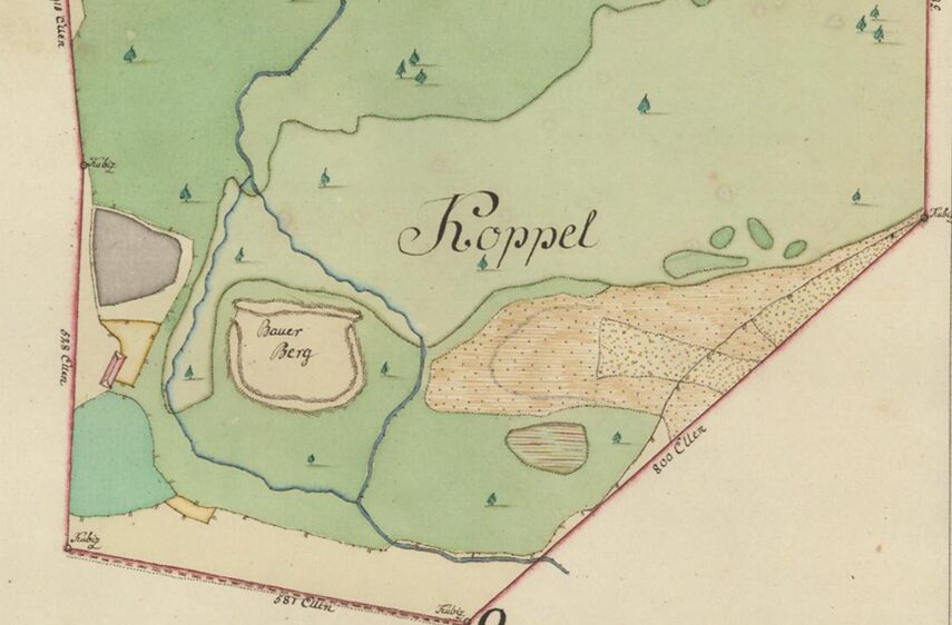
Kaarma hill fort on the map of 1794 (EAA.2072.3.426a leht 16e foolio 5, fragment).
Põduste river. View of the eastern side of Kaarma hHill fFort.
The shape of the stronghold is approximately semicircular, measuring around 140 × 120 meters. The courtyard area is nearly 4800 m2. The stronghold has only been excavated by J. B. Holzmayer in 1860. According to his research, there is a stone-lined well in the courtyard, the ramparts are piled up with soil and stones, and they had additional log fortifications, which have burned down. The few preserved finds probably date from the 13th century. It is not known whether the stronghold was also in use during earlier period.
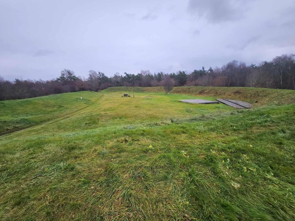
The ramparts of Kaarma hill fort from the west.
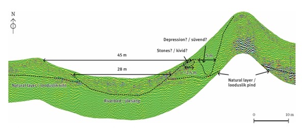
Since 2022, Osiliana has been working with H. Tõnisson and O. Harjo to study Kaarma hill fort using ground-penetrating radar. It has been found that, similar to other large hill forts on Saaremaa, Kaarma is also surrounded by a lower circular rampart, the remains of which can be seen on the LiDAR map. Buildings can also be seen on the horizontal sections of the ground-penetrating radar inside the fort.
Ramparts of Kaarma hill fort. Geoportal of the Land and Spatial Development Board.
Cross-section of the western side of Kaarma hill fort made with ground-penetrating radar. Drawing: Hannes Tõnisson, Olav Harjo.
Finds from Kaarma Hill Fort or its vicinity, dating from the 12th–13th centuries: cross-headed brooch (AI-K 59:1) and bracelet (AI-K 59:2).
Kaarma hill fort in written sources
Kaarma hill fort is first mentioned in written sources in the Livonian Rhymed Chronicle under the name “einen hagen … Carmele.” In 1261, the Teutonic Order with allied forces attacked Saaremaa, whose inhabitants were said to have renounced Christianity. The forces reached the hagen – a wording that has caused quite a confusion. It refers more to a wooden fortification or palisade than to a hillfort.
Based on our current knowledge, there were “towns” situated around or near the Saaremaa strongholds. These were probably semi-seasonal settlements or gathering places, which were sometimes fortified, but only weakly, for example, partly with stone and partly with wooden fences. Henry of Livonia used the word urbs to refer to them. It is possible that only such a “town” was plundered in Kaarma, which would also explain the subsequent negotiations with the local nobles, who, according to the Rhymed Chronicle, were staying in a safe place nearby – perhaps in the stronghold itself. It is also possible that the term hagen referred to the wooden fence on the lower rampart surrounding Kaarma’s hill fort, which had been broken through. However, the exact location and nature of Kaarma’s “town” still requires further research.